Seydisfjordur, Iceland is one of Iceland's most picturesque towns,
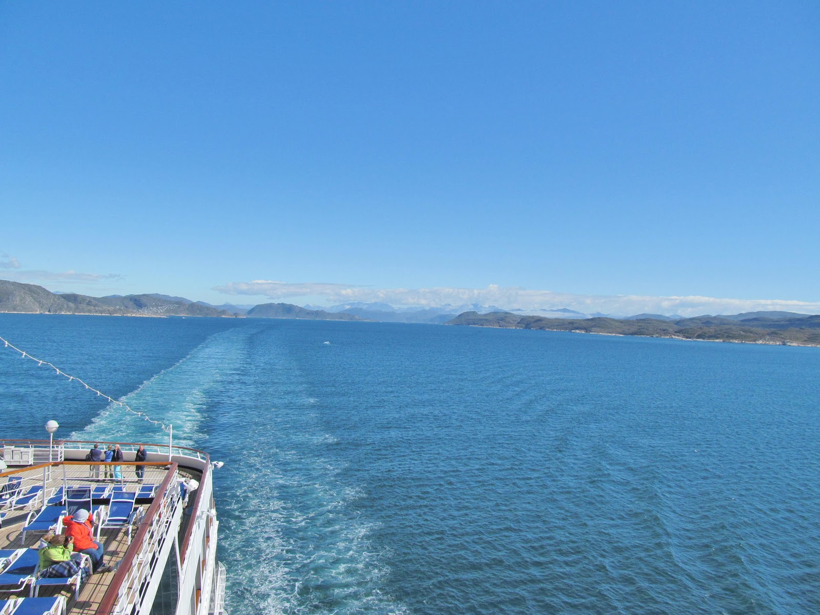
Seydisfjordur is located on a long, calm, deep fjord at the base of the
mountains. The community of attractive old wooden homes is a charming location.
Seydisfjordur fjord is 8.5 nautical miles long and is surrounded by steep
mountains. Depths in the fjord vary from 121 feet to 295 feet. Seydisfjordur
town is an important fishing port and lies at the head of the fjord. Fjardhara,
a river, divides the town into two parts. Its mouth is spanned by an iron
bridge. In a world dwindling natural habitat, the rugged setting is especially
breathtaking. Icelandic Poet Matthias Johannessen referred to Seydisfjordur as
"a pearl enclosed in a shell."


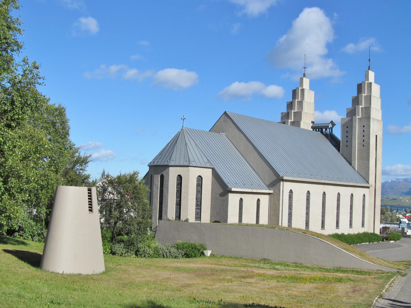


Akureyri, Iceland (population 14,000), may well be the best of urban
Iceland. Its setting is superb and sunny days are the norm in this small and
tidy city planted beneath perpetually snow-capped peaks near the head of
Eyjafjordur ("Island Fjord", after Hrisey Island near its mouth). Akureyri began
as a trading center just before the Danish Trade Monopoly of 1602 came into
effect. Although the town was used for commercial enterprises, no one actually
lived there as all the settlers maintained rural farms and homesteads. After
business had boomed for a century and a half, Akureyri's first actual residence
was built in 1777. By the late 1700's, the town ha accumulated a whopping 10
residents, all Danish traders. By the turn of the century, Akureyri numbered
1,370 people. The Akureyri Fishing Company is Iceland's largest, and the city's
shipyard is also the busiest in the country. Before the decline in herring
stocks off northern Iceland, herring salting was the city's largest industry.
Fishing remains important, but the emphasis is now on trawling, canning and
freezing larger fish. At present, Akureyri's expanding industrial base includes
such diverse enterprises as brewing, food processing, and tourism.


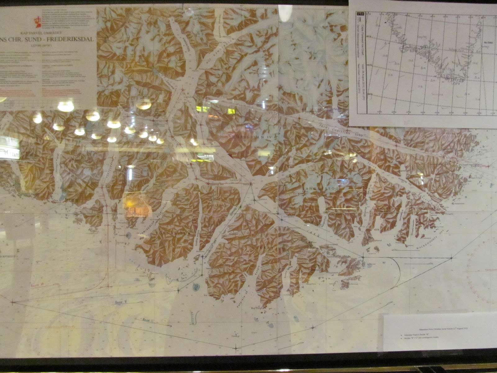


Qaqortoq, Greenland, is located in the southern part of Greenland where
there's ruins from Viking communities dating back over 1,000 years and several
relics can be found in the small museum located near the pier in Qaqortoq.
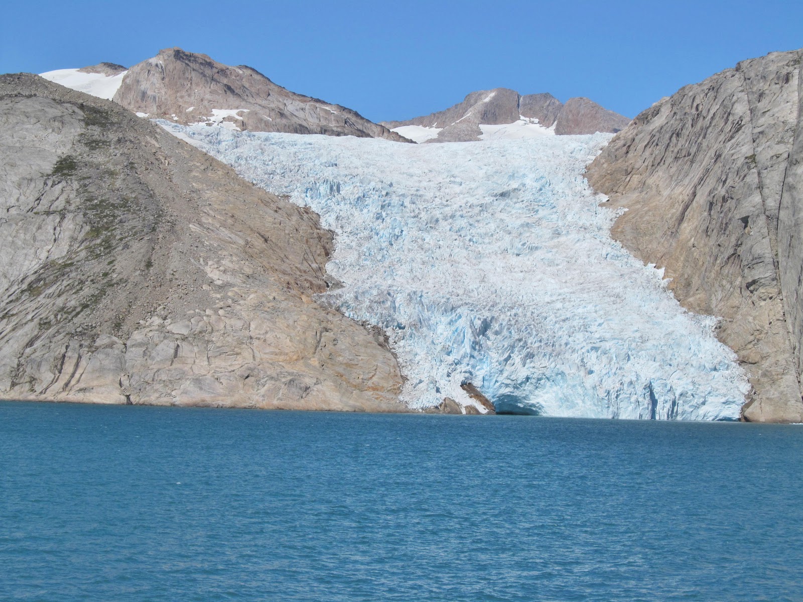
Today Qaqortoq is a community of 3,500 inhabitants. Greenland, an island
comprised for the most part of vast ice fields is home to approximately 57,000
inhabitants. In the native language, Greenlandic, the name of the country is
Kalqaaliit Nunaat and is the world's largest island (discounting the island
continent Australia) with an area of 840,000 square miles. The capital is Nuuk
and it is a dependency of Denmark. Greenland extends 1,660 miles from north to
south, and more than 650 miles from east to west. It consists of vast interior
ice fields measuring up to 9,800 feet in depth and a mountainous ice free rim
around the southwest and southeast coast. The ice fields cover the ancient rocks
of the Greenland Shield which is closely related to the Canadian Shield. The
climate is extremely cold in the north and in the interior but during the short
summer months the mean temperature along the southwestern coastline can be in
the mid 40's.


St. John's is the capital of Newfoundland and Labrador and the province's
largest city. Situated on the Avalon Peninsula, it is the easternmost city of
North America and one of the oldest inhabited ports on the continent. Norseman
BJarni Herjolfasson sighted Newfoundland in 986 AD, making him the first
European to sight the New World. John Cabot rediscovered and named Newfoundland
in 1497. St. John's has been the site of several significant events, including
Marconi's first reception of radio signals across the Atlantic in 1901 at Cabot
Tower on Signal Hill, and the 1919 departure of Alcock and Brown on the first
successful transatlantic flight. Newfoundland and Labrador became Canada's
newest province and the 10th province on March 31, 1949. The first use of the
name Newfoundland was in 1497, in an English registry recording the discovery of
Terra Nova or the "new found land." While many Europeans saw or visited
Newfoundland, it John Cabot while sailing for Henry VII in 1497 who garnered
much interest in the area with his reports the spoke of "the sea swarming with
fish, which can be taken not only with the net, but in baskets let down with a
stone." Thus began the great years of fishing when vast fleets from England and
France sailed and fished the waters of Newfoundland, contributing millions to
the economy. The decision to become part of Canada took many years and two
public referendums. In the second referendum, union with Canada was chosen by
52% of the voters. Joseph Smallwood became the first premier.


Bar Harbor, Maine has its historical roots in the grand resort era of the
late 19th century, as the newly affluent middle class flocked here in the summer
by steamboat and rail from Boston, New York, Philadelphia and Washington, D.C.
When the resort was at its peak near the turn of the last century, Bar Harbor
had rooms enough to accommodate some 5,000 visitors. Along with the hotels and
guest houses, hundreds of cottages were built by the most wealthy rusticators,
who came here season after season. The tourist business continued to grow
through the early part of the 1900s, then all but collapsed as the Great
Depression and growing popularity of automobile travel doomed the era of the
extended vacation. Bar Harbor was dealt a further blow in 1947, when a fire
leveled many of the most opulent cottages and much of the rest of the town. In
all, some 17,000 acres of the island were burned. Downtown Bar Harbor was
spared, and many of the grand homes in town along the oceanfront were missed by
the conflagration. After a period of quiet slumber, Bar Harbor has been
rejuvenated and rediscovered in recent years as tourists have poured into this
area and entrepreneurs have followed them, opening dozens of shops, restaurants
and boutiques.


No comments:
Post a Comment